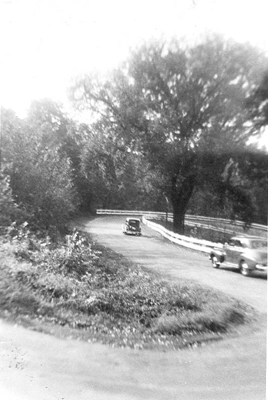
THE FAMOUS "S" CURVE
that led up a steep hill to Harveysburg
from the valley of Caesar's Creek
Old State Rte 73 (Wilmington~Waynesville Road)
that led up a steep hill to Harveysburg
from the valley of Caesar's Creek
Old State Rte 73 (Wilmington~Waynesville Road)
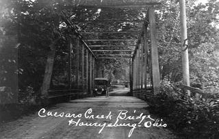
The bridge crossing Caesar's Creek at the
bottom of the Harveysburg hill (now underwater).
bottom of the Harveysburg hill (now underwater).
"The first bridge on Caesar's Creek was built in 1846 a the present crossing of the Waynesville and Wilmington Turnpike. It was built by the county aided by private subscriptions. It was covered, weather-boarded and painted by the county in 1848. On the 7th of January 1850, it was washed away, and in the same year was replaced by a substantial 120 foot span, arch bridge, which was burned by incendiaries on the 9th of February 1876. The county then built in its stead the present handsome and substantial iron sturcture" (Beer's 1882 History of Warren County, Ohio, p. 652).


The "S" curve looking from the top of the hill.
In the distance can be seen the valley of Caesar's Creek.
The valley is now Caesar's Creek Lake.
In the distance can be seen the valley of Caesar's Creek.
The valley is now Caesar's Creek Lake.
Below: Photos of the "S" Curve from the 1940s:

posted by Karen Campbell at 9:03 AM
![]()

1 Comments:
I remember this hill, WELL!
Love it as a child
Post a Comment
<< Home